Trail Walking La Bastide-des-Jourdans - la bastide des jourdan.  - Photo
 Roger
Roger

User

© OpenStreetMap contributors
Length
Length
9.4 km
Max alt
Max alt
690 m
Uphill gradient
Uphill gradient
310 m
Km-Effort
Km-Effort  
13.5 km
Min alt
Min alt
451 m
Downhill gradient
Downhill gradient
319 m
Boucle
Boucle
Yes
Creation date :
2022-09-04 06:27:04.992
Updated on :
2022-09-04 09:31:49.353

(0 Reviews)

Walking
Walking
2h55
Difficulty : Medium

Scan this QR Code to open this trail in the SityTrail application

FREE GPS app for hiking

Logo SityTrail SityTrail

IGN / Geographical institutes

Download SityTrail from the App Store Download SityTrail from Google Play

Logo SityTrail SityTrail World

The world is yours!

Download SityTrail from the App Store Download SityTrail from Google Play Download SityTrail on Huawei AppGallery

About

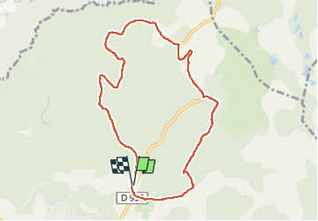
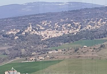
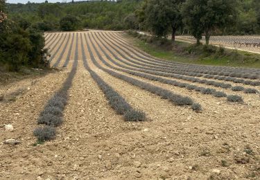
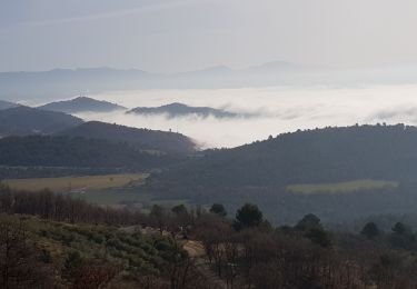
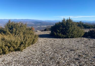
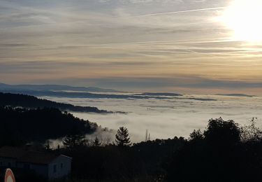
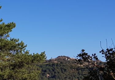
Trail Walking of 9.4 km to be discovered at Provence-Alpes-Côte d'Azur, Vaucluse, La Bastide-des-Jourdans. This trail is proposed by Roger .

Description

garder le pipe line pour arrivé à la route ( propriété privée)

Elevation profile

Photos

Positioning

Country:
France
Region :
Provence-Alpes-Côte d'Azur
Department/Province :
Vaucluse
Municipality :
La Bastide-des-Jourdans
Location:
Unknown
Start:(UTM)
712482 ; 4852590 (31T) N.

Comments

Please log in to post a review or rate the element


la description complete svp


Trails nearby

Trail Cycle La Bastide-des-Jourdans - Parcours n°21 - La Bastide-des-Jourdans - Photo
Cycle
GUIDE+

Cycle

Medium
(2)
La Bastide-des-Jourdans, Provence-Alpes-Côte d'Azur, Vaucluse, France
40 km | 49 km-effort
2h 49min
Yes
Trail Walking La Bastide-des-Jourdans - Les Collets du Luberon Est - Photo
Walking
ALAPETITE

Walking

Medium
(1)
La Bastide-des-Jourdans, Provence-Alpes-Côte d'Azur, Vaucluse, France
17.9 km | 26 km-effort
5h 50min
Yes
Trail Walking Peypin-d'Aigues - Peypin-d’Aigues d’Aigues les Dones nord - Photo
Walking
Dadou 1

Walking

Medium
Peypin-d'Aigues, Provence-Alpes-Côte d'Azur, Vaucluse, France
7.3 km | 11.5 km-effort
2h 41min
Yes
Trail Walking Montfuron - 1Montfuron, Villemus via la Colle et le Moulin. - Photo
Walking
liocol

Walking

Easy
Montfuron, Provence-Alpes-Côte d'Azur, Alpes-de-Haute-Provence, France
7.6 km | 9.9 km-effort
2h 4min
Yes
Trail Walking Grambois - La Pourraque Beaumont de Pertuis 84 - Photo
Walking
Dadou 1

Walking

Easy
Grambois, Provence-Alpes-Côte d'Azur, Vaucluse, France
8.1 km | 10.6 km-effort
2h 34min
Yes
Trail Walking Montfuron - 1Montfuron, le relais de Villemus - Photo
Walking
liocol

Walking

Medium
Montfuron, Provence-Alpes-Côte d'Azur, Alpes-de-Haute-Provence, France
8 km | 11.2 km-effort
2h 9min
Yes
Trail Walking Céreste - Col des Mascas 84 - Photo
Walking
Dadou 1

Walking

Very easy
Céreste, Provence-Alpes-Côte d'Azur, Alpes-de-Haute-Provence, France
8.3 km | 11.9 km-effort
3h 45min
Yes
Trail Walking Montfuron - Montfuron à Villemus, variante.  - Photo
Walking
liocol

Walking

Easy
(2)
Montfuron, Provence-Alpes-Côte d'Azur, Alpes-de-Haute-Provence, France
7.6 km | 9.8 km-effort
2h 3min
Yes
Trail Walking Montfuron - 1Montfuron, via les Granges et le chemin Mériton - Photo
Walking
liocol

Walking

Difficult
Montfuron, Provence-Alpes-Côte d'Azur, Alpes-de-Haute-Provence, France
9.5 km | 13.9 km-effort
2h 36min
Yes


Close
My subscriptions